About
This registry exists to help people discover and share collections that are available via Euro Data Cube
See all usage examples for collections listed in this registry tagged with agriculture.
Search collections (currently 13 matching collections)
You are currently viewing a subset of data tagged with agriculture.
Add to this registry
If you want to add a collection or example of how to use a collection to this registry, please follow the instructions on the Euro Data Cube Public Collections GitHub repository.
Unless specifically stated in the applicable collection's documentation, collections available through the Euro Data Cube Public Collections are not provided and maintained by Euro Data Cube. Collections are provided and maintained by a variety of third parties under a variety of licenses. Please check collection licenses and related documentation to determine if a collection may be used for your application.
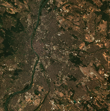
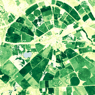
EOxCloudless Sentinel-2 10m Global Cloudless Mosaic
agriculturecloudlesscommercial dataEOXEOxCloudlessglobalmachine learningmapsmulti spectral imageryon-demandrastersatellite imagerysystematic
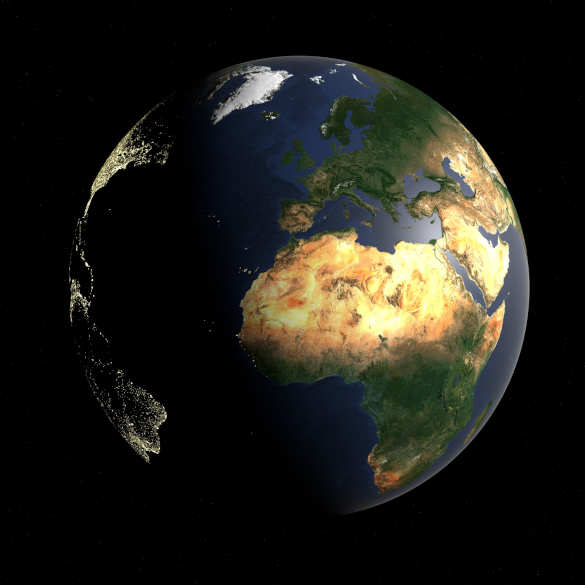
EOxCloudless Sentinel-2 10m Global Cloudless Mosaic is a derived product, created to provide an almost cloudfree global dataset every year. Details about the EOxCloudless products available at EDC are provided on the Additional info page. For a detailed description of the generally available products please refer to EOxCloudless.
Usage examples
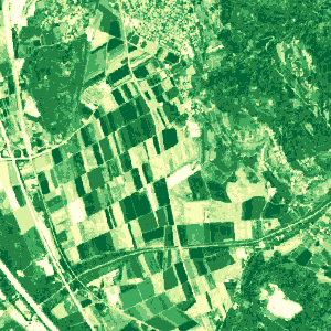
Sentinel-2 L2A 120m Mosaic
agriculturemachine learningmulti spectral imageryopen datarastersatellite imagerysentinelsentinel hubsystematicxcube
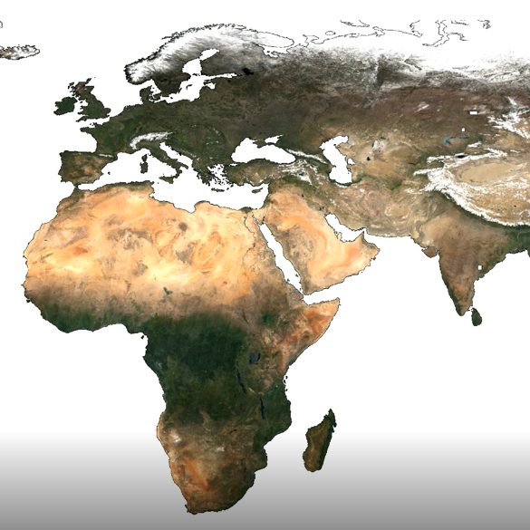
Sentinel-2 L2A 120m mosaic is a derived product, which contains best pixel values for 10-daily periods, modelled by removing the cloudy pixels and then performing interpolation among remaining values. As clouds can be missed in the removal process and as there are some parts of the world, which have lengthy cloudy periods, clouds might be remaining in some parts. The actual modelling script is available here.
Usage examples
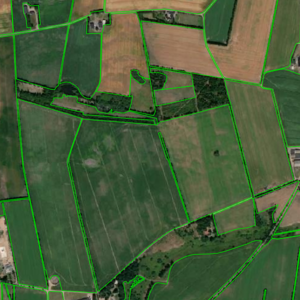
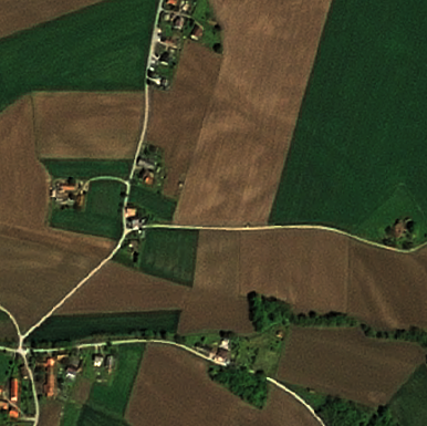
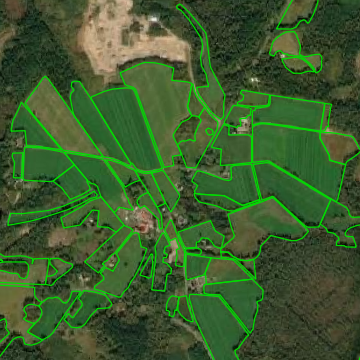
Belgium - Flanders GSAA
agriculturecommercial datageoDBgsaaLandbouwgebruikspercelenmachine learningparcelvector
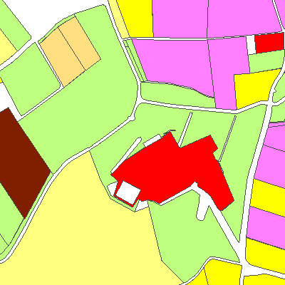
Flemish Geo-spatial Aid Application (GSAA) data is managed by the Belgium Department of Agriculture and Fisheries. It contains the parcels that are in agricultural use on the deadline for submission of the single application that year. The register also includes pounds, wood edges and agricultural production facilities (stables and similar buildings). The inventory of these parcels takes place annually in the context of the payment of the (co-financed) European agricultural subsidies and the Flemish manure legislation. It can be used for consultation or study of the land use of agricultural...
Denmark GSAA
agricultureCAPcommercial datageoDBgsaaland usemachine learningmarkervector
Danish Geo-spatial Aid Application (GSAA) data collection is managed by the Danish Agency for Agriculture. The data is made available for download on the agency’s website. Additionally, the metadata are made available and can be searched on Geodata-info.dk which is managed by the Danish Agency for Data Supply and Efficiency. This collection is comprised of agricultural fields ("Marker") which are an extract of fields notified to the Danish Agency for Agriculture from the most recent application year. A field is defined as a contiguous area on which one crop is grown. Denmark GSAA...
Denmark LPIS
agriculturecommercial datageoDBlanduselpismachine learningmarkblokkevector
Danish Land Parcel Identification System (LPIS) data collection or (field blocks/ 'Markblokke') is managed by The Danish Agency for Agriculture. The data is made available for download on the agency’s website. Additionally, the metadata are made available and can be searched on Geodata-info.dk geoportal with the search term ‘Markblokke’. The field blocks are comprised of polygons representing the country's agricultural areas. The polygons are manually created by the agency annually based on most recent orthophotos. LPIS collection contains attributes for geographical area, elig...
ESA WorldCover
agriculturebiodiversityderived dataland coveropen dataworldcover
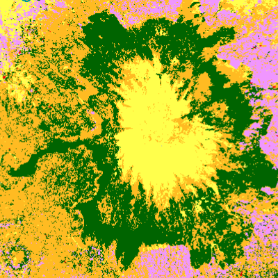
The European Space Agency (ESA) WorldCover is a global land cover map with 11 different land cover classes produced at 10m resolution based on combination of both Sentinel-1 and Sentinel-2 data. In areas where Sentinel-2 images are covered by clouds for an extended period of time, Sentinel-1 data then provides complimentary information on the structural characteristics of the observed land cover. Therefore, the combination of Sentinel-1 and Sentinel-2 data makes it possible to update the land cover map almost in real time. WorldCover Map was first produced for 2020 using v100 of the algorit...
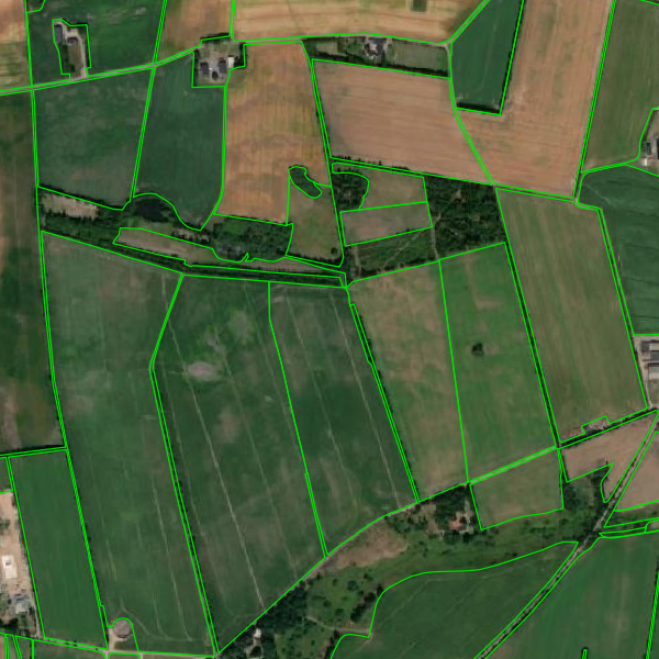
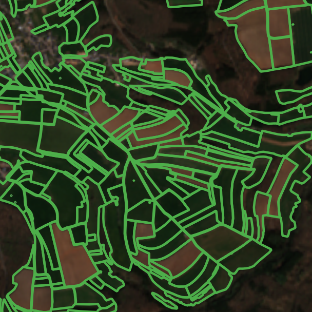
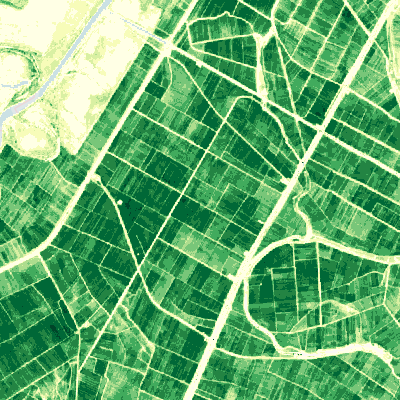
EuroCrops
agriculturegeoDBland usemachine learningopen datavector
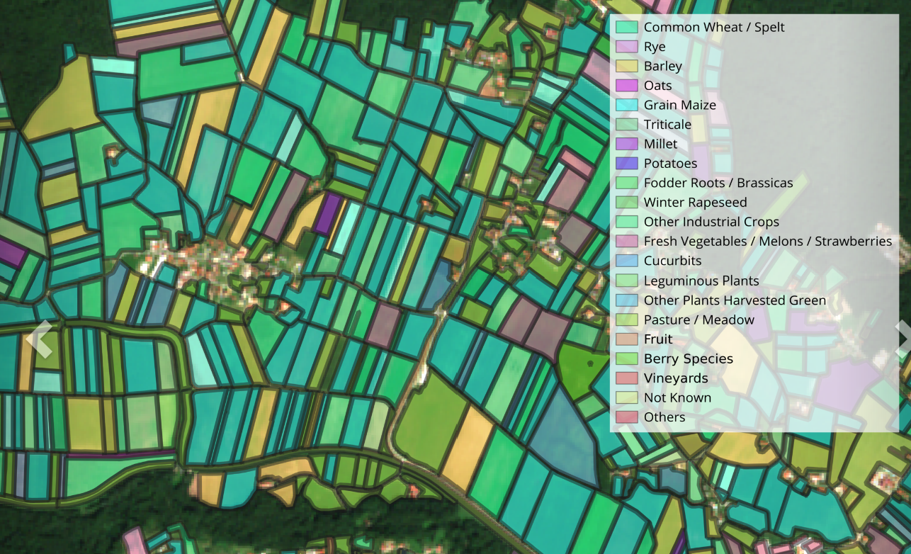
EuroCrops is a dataset collection combining all publicly available self-declared crop reporting datasets from countries of the European Union. The project is funded by the German Space Agency at DLR on behalf of the Federal Ministry for Economic Affairs and Climate Action (BMWK). This work is licensed under a Creative Commons Attribution 4.0 International License.
France Metropolitan GSAA
agricultureCAPcommercial datageoDBgsaamachine learningRegistre parcellaire graphiquevector
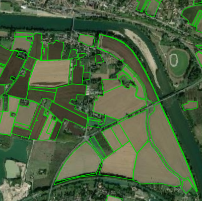
The Graphical Parcel Register (Registre parcellaire graphique (RPG) is a geographical database allowing the identification of agricultural parcels. Its primary purpose is to provide a spatial reference for aid applications under the Common Agricultural Policy (CAP). The anonymised version of RPG with information on the main crop on the agricultural parcel is publicly available. RGP is managed by the Service and Payment Agency (ASP).France Metropolitan GSAA data collection is made available on geoDB on subscription basis.
Harmonized Landsat Sentinel
agriculturecopernicusdisaster responselandsatLULC changeLULC mappingmulti spectral imagerynatural resourceopen datarace challengesrastersatellite imagerysentinelsentinel hubsystematicvegetation monitoringxcube
Harmonized Landsat Sentinel is a NASA initiative to produce a Virtual Constellation of surface reflectance (SR) data from the Operational Land Manager (OLI) and Multi-Spectral Instrument (MSI) aboard the Landsat 8-9 and Sentinel-2 remote sensing satellites, respectively. The combined measurement enables global observations of the land every 2-3 days. Input products are Landsat 8-9 Collection 2 L1 and S2-L1C top-of-atmosphere reflectance. Landsat data is available from April 2013 and Sentinel-2 data from November 2015.
Luxembourg LPIS
agricultureCAPcommercial dataFLIKgeoDBland coverlpismachine learningparcelles agricolesvectorvineyardwine-growing
Luxembourg's Land Parcel Identification System (LPIS) data collection (also agricultural plots/ 'parcelles agricoles') is managed by The administration of agricultural technical services (ASTA) and made available on The Luxembourg data platform. In Luxembourg, it is referred to as plot-based parcel reference system (FLIK), an identification system for agricultural and wine-growing parcels which serves as th...
MODIS MCD43A4.006
agricultureaquadisaster responsemodisNASAnatural resourceopen datarastersatellite imagerysentinel hubsystematicterraxcube
MODIS (Moderate Resolution Imaging Spectroradiometer) is the main instrument operating on both NASA's Terra and Aqua satellites. It acquires images of the earth in 36 bands within the visible and the infrared regions of the spectrum at low to medium spatial resolutions. MODIS is designed to provide at least daily observations of land, oceans and lower atmosphere that contribute to local or global scale land or water applications. There are several products derived from MODIS which include land, atmosphere, cryospehere and ocean products. MCD43A4 Nadir BRDF-Adjusted Reflectance (NBAR) prod...
PlanetScope
agriculturecommercial datahigh resolution imagerymappingmulti spectral imageryrastersatellite imagerysentinel hubvegetation monitoringxcube
PlanetScope is a satellite constellation of more than 130 satellites called Doves and is operated by Planet. Each Dove satellite is a CubeSat made of three cubic units and thus measures only 10 cm x 10 cm x 30 cm. The satellites are launched in groups, and together manage to acquire images covering the entire earth land surface atleast daily. Sentinel Hub offers a possibility to purchase, order and access PlanetScope both archive and newly acquired data which is available globally since 2016. Sentinel Hub offers access to PlantScope data in Top of the atmosphere (TOA) reflectance.
SPOT
agriculturecommercial datadisaster responsehigh resolution imagerymulti spectral imageryrastersatellite imagerysentinel hubvegetation monitoringxcube
SPOT 6/7 is a satellite constellation providing high-resolution optical imagery in Panchromatic and Multispectral bands and is owned by Airbus. SPOT 6/7 is composed of two twin satellites that offer a daily revisit capability to any point on the globe. Spot offers both tasking capability and imagery archive of tasked acquisitions. Sentinel Hub offers a possibility to purchase, order and access SPOT 6/7 imagery archive which is available globally since 2012. Sentinel Hub provides SPOT images in Top of the atmosphere (TOA) reflectance.
Seasonal Trajectories, 10-daily
agricultureCLMScopernicus servicesderived dataopen dataphenologyPlant phenology indexvegetation
Seasonal Trajectories (ST) product is a filtered time series of Plant Phenology Index (PPI) provided yearly on a 10-daily basis at 10m resolution . It is part of the Copernicus Land Monitoring Service (CLMS), pan-European High Resolution Vegetation Phenology and Productivity (HR-VPP) product suite. The Seasonal Trajectories PPI is derived through fitting a smoothing and gap filling function to the yearly time-series raw PPI values generated from Sentinel-2 satellite observations. In addition to the PPI band, a QFLAG band indicating the quality of the smoothing process is included. The Seasonal...
Sentinel-2 L1C
agriculturecopernicusdisaster responsemulti spectral imagerynatural resourceopen datarace challengesrastersatellite imagerysentinelsentinel hubsystematicxcube
The Sentinel-2 mission is a land monitoring constellation of two satellites that provide high resolution optical imagery and provide continuity for the current SPOT and Landsat missions. The mission provides a global coverage of the Earth's land surface every 5 days, making the data of great use in on-going studies. L1C data are available from June 2015 globally. L1C data provide Top of the atmosphere (TOA) reflectance.
Sentinel-2 L2A
agriculturecopernicusdisaster responsemulti spectral imagerynatural resourceopen datarace challengesrastersatellite imagerysentinelsentinel hubsystematicxcube
The Sentinel-2 mission is a land monitoring constellation of two satellites that provide high resolution optical imagery and provide continuity for the current SPOT and Landsat missions. The mission provides a global coverage of the Earth's land surface every 5 days, making the data of great use in on-going studies. L2A data are available from September 2016 over wider Europe region and globally since January 2017. L2A data provide Bottom of the atmosphere (BOA) reflectance.
Sweden LPIS
agriculturearable landcommercial datageoDBjordbruksblocklanduselpismachine learningpasturevector
Sweden's Land Parcel Identification System (LPIS) data collection (also agricultural blocks/ 'jordbruksblock') is managed by the Swedish Board of Agriculture, and also made available on the INSPIRE Geoportal. The Swedish agricultural blocks are vector data containing information on maximum eligible agricultural land according to EU definitions. The agricultural blocks are used by the Swedish Board of Agriculture to administer support to farmers, therefore the collection does not include all agricultural land in Sweden, but only the parts that a farmer has sought support for at s...
Vegetation Indices, Daily
agricultureCLMScopernicus servicesderived dataopen dataphenologyPlant phenology indexvegetation
Vegetation Indices (VI) product is part of the Copernicus Land Monitoring Service (CLMS), pan-European High Resolution Vegetation Phenology and Productivity (HR-VPP) product suite. The product is comprised of 4 raw Vegetation Indices; (1) Normalized Difference Vegetation Index (NDVI), (2) Leaf Area Index (LAI), (3) Fraction of Absorbed Photosynthetically Active Radiation (FAPAR) and (4) Plant Phenology Index (PPI) generated near real-time (NRT) from Sentinel-2 satellite observations. The raw Vegetation Indices are provided on a daily basis at 10m resolution from October 2016 onwards. Therefore...
Vegetation Phenology and Productivity Parameters Season 1, Yearly
agricultureCLMScopernicus servicesderived dataopen dataphenologyPlant phenology indexvegetation
Vegetation Phenology and Productivity Parameters (VPP) product is part of the Copernicus Land Monitoring Service (CLMS), pan-European High Resolution Vegetation Phenology and Productivity (HR-VPP) product suite. The VPP product is comprised of 13 parameters that describe specific stages of the seasonal vegetation growth cycle. These parameters are extracted from Seasonal Trajectories of the Plant Phenology Index (PPI) derived from Sentinel-2 satellite observations at 10m resolution. Since growing seasons can traverse years, VPP parameters are provided for a maximum of two growing seasons pe...
Vegetation Phenology and Productivity Parameters Season 2, Yearly
agricultureCLMScopernicus servicesderived dataopen dataphenologyPlant phenology indexvegetation
Vegetation Phenology and Productivity Parameters (VPP) product is part of the Copernicus Land Monitoring Service (CLMS), pan-European High Resolution Vegetation Phenology and Productivity (HR-VPP) product suite. The VPP product is comprised of 13 parameters that describe specific stages of the seasonal vegetation growth cycle. These parameters are extracted from Seasonal Trajectories of the Plant Phenology Index (PPI) derived from Sentinel-2 satellite observations at 10m resolution. Since growing seasons can traverse years, VPP parameters are provided for a maximum of two growing seasons per y...