Sentinel-1 GRD CARD4L Processing
Short Description
Sentinel Hub provides the full archive of global Sentinel-1 GRD data, which can be processed based on
CARD4L NRB (Normalised Radar Backscatter) requirements to reduce the complexity of SAR data. The satellite data is processed to a minimum set of requirements and organized into a form, that allows immediate analysis with minimum user effort. Through the Euro Data Cube
Insights On Demand service, you can trigger on-demand processing of CARD4L compliant Sentinel-1 GRD data through
EDC Browser and have the products delivered to a specified S3 bucket.
To access sample processed data, we provide freely accessible Sentinel-1 GRD archived CARD4L data covering Africa Continent
here, in collaboration with
Geoscience Australia and
ESA.
Steps to process Sentinel-1 CARD4L data
- Create EDC account here and purchase enough credits
- Navigate to EDC Browser
- Select the required input parameters
- Follow the check-out wizard to complete your order.
Based on the selected input parameters, an analysis is run to determine the number of datatakes, distinct dates and total area of the data to be processed. The processing is currently limited to 20 datatakes. For larger orders, customers should get in contact with
Sentinel Hub support.
Table 1: Required parameters
| Parameter |
Possible values |
Description |
| Area of Interest |
Polygon or Rectangle |
Area of Interest |
| Time range |
From 2014-10-01 to date |
Start and end date of the data to be processed |
| Bucket Name |
The name of the AWS S3 bucket where the processed products will be delivered |
Bucket must be in eu-central-1 region and configured to allow full access to Sentinel Hub. Check aws bucket settings |
Product specifications
Table 2: Sentinel-1 CARD4L product specifications
| Specification |
Description |
| Data source |
Sentinel-1 GRD (read more) |
| Sensor |
C-SAR |
| Frequency |
C-band (5.405 GHz) |
| Acquisition mode |
Interferometric Wide (IW) swath mode (read more ). |
| Polarisation |
VV + VH |
| Backscatter |
Gamma-0 (γ°) |
| Backscatter scaling |
Linear power |
| Coordinate reference system |
EPSG: 4326 |
| Pixel spacing - X (degree) |
0.0002 (≈22.2 m at the Equator) |
| Pixel spacing - Y (degree) |
0.0002 (≈22.2 m at the Equator) |
| Number of bands |
5 |
| Radiometric Terrain Correction |
Yes, based on Flattening Gamma: Radiometric Terrain Correction for SAR Imagery |
| Digital Elevation Model |
Copernicus DEM (10m in EEA, 30m elsewhere) |
Table 3: Output Bands
Read more details on the bands
here
| Name |
Description |
Typical Range |
Sentinel Hub units |
| VV |
Linear backscatter intensity in VV polarization |
0 - 0.5 (Can reach very high values such as 1000) |
LINEAR_POWER |
| VH |
Linear backscatter intensity in VH polarization |
0 - 0.5 (Can reach very high values (such as 1000) |
LINEAR_POWER |
| MASK |
Data mask |
0, 1, 2 |
DN |
| AREA |
Normalized scattering area |
0 - 2 (Can reach high values on fore-slopes.) |
DN |
| ANGLE |
Local incidence angle |
0 - 180 degree |
DN |
| Name |
Description |
| userdata.json |
Intermediate metadata used to produce final CARD4L metadata |
| metadata.json |
Local incidence angle |
| metadata.xml |
STAC compliant CARD4L compliant general metadata |
Table 5: Data mask definition
| Value |
Description |
| 0 |
Nodata |
| 1 |
Valid data |
| 2 |
Invalid (in/near radar shadow) |
Pricing
| Price |
Unit |
| 10 EUR |
1.000.000 km² |
Resources
Examples
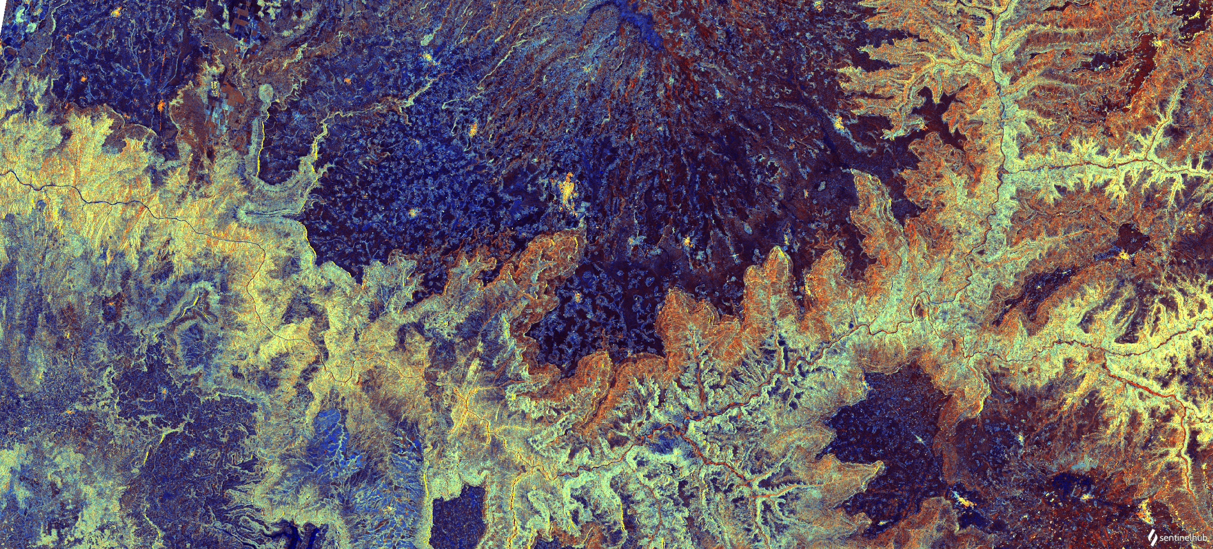
 RGB visualisation of Blue Nile river looping across northwest Ethiopia . Contains modified Copernicus data [2022], processed by Sentinel Hub.
 RGB visualisation of Blue Nile river looping across northwest Ethiopia . Contains modified Copernicus data [2022], processed by Sentinel Hub.