Water Bodies
Short description
The Global Water Bodies product shows the surface extent covered by inland water on permanent, seasonal or occasional basis. The product available here is the
Water Bodies 100m Version 1 collection which is derived from Sentinel-2 level 1C data, starting from October 2020 after the end of the PROBA-V mission and is delivered as a monthly composite product at 100m resolution. The Water Bodies product contain one main Water Bodies detection layer (WB) and one Quality layer (QUAL) that provides information on the seasonal dynamics of the detected water bodies. Water Bodies detection layer (WB) shows water bodies detected using the Modified Normalized Difference Water Index
(MNDWI) derived from Sentinel-2 Level 1C data. The Quality layer (QUAL) is generated from water body occurrence statistics computed from previous monthly Water Bodies products.The occurrence statistics is ranked from low occurrence to permanent occurrence.More information about the data can be obtained from the
Water Bodies product page.
Water Bodies product contain 2 bands (WB and QUAL) and are described in Table 1 below.
Table 1: Bands
| Name |
Units |
Values |
Description |
| WB |
DN |
70 |
Main Water Bodies detection layer showing water pixels and non-water pixels
- 0 = Sea
- 70 = Water
- 251 = No data
- 255 = No water
|
| QUAL |
DN |
71 - 76 |
Quality layer which gives information on water bodies occurrence
- 0 = Sea
- 71 = Very low occurence
- 72 = Low occurence
- 73 = Medium occurence
- 74 = High occurence
- 75 = Very high occurence
- 76 = Permanent occurence
- 251 = No data
- 252 = Cloud
- 255 = Not water
|
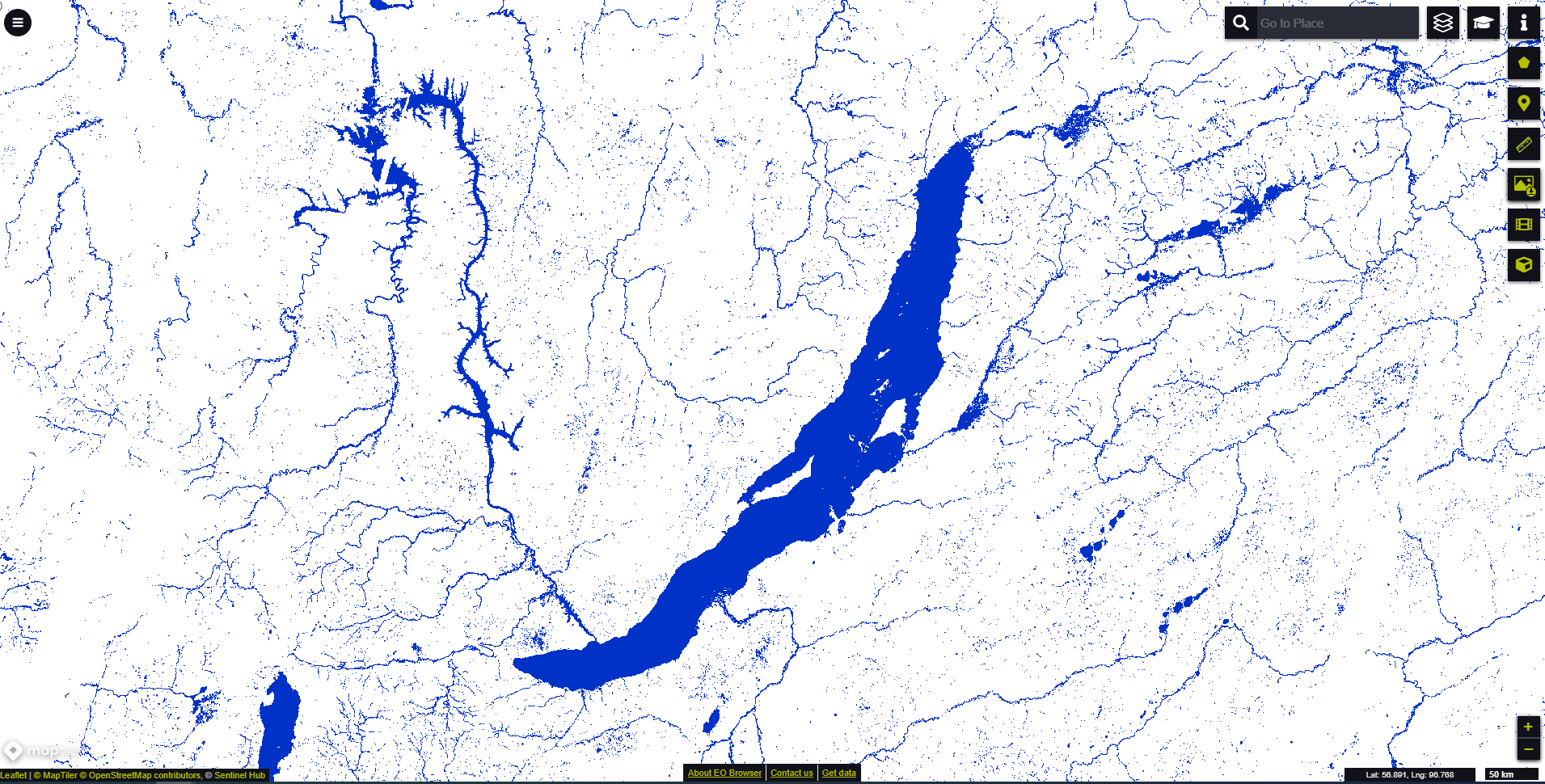 October 2020 monthly composite map showing surface water body extent around Russia's largest freshwater lake Baikal visualised in EO browser
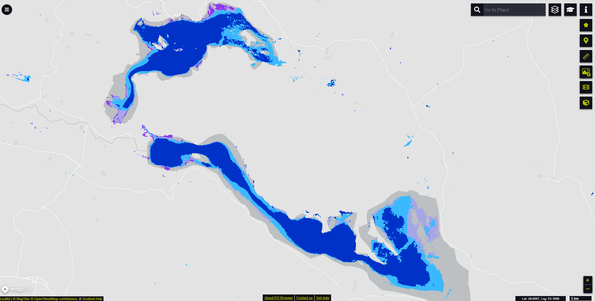 December 2020 water body occurrence on Iran's second largest salt lake Bakhtegan and lake Tashk visualised in EO browser