Population Density
Short description
The Gridded Population of the World (GPW) collection, now in its fourth version (GPWv4), models the distribution of human population (counts and densities) on a continuous global raster surface. Since the release of the first version of this global population surface in 1995, the essential inputs to GPW have been population census tables and corresponding geographic boundaries. The purpose of GPW is to provide a spatially disaggregated population layer that is compatible with data sets from social, economic, and Earth science disciplines, and remote sensing. It provides globally consistent and spatially explicit data for use in research, policy-making, and communications.For GPWv4, population input data are collected at the most detailed spatial resolution available from the results of the 2010 round of Population and Housing Censuses, which occurred between 2005 and 2014. The input data are extrapolated to produce population estimates for the years 2000, 2005, 2010, 2015, and 2020. A set of estimates adjusted to national level, historic and future, population predictions from the United Nation's World Population Prospects report are also produced for the same set of years. The raster data sets are constructed from national or subnational input administrative units to which the estimates have been matched. GPWv4 is gridded with an output resolution of 30 arc-seconds (approximately 1 km at the equator).Band information
The product contains one single band named "populationDensity" expressed in .More information
- Data Source
- Data Documentation
- Palisades, NY: NASA Socioeconomic Data and Applications Center (SEDAC)
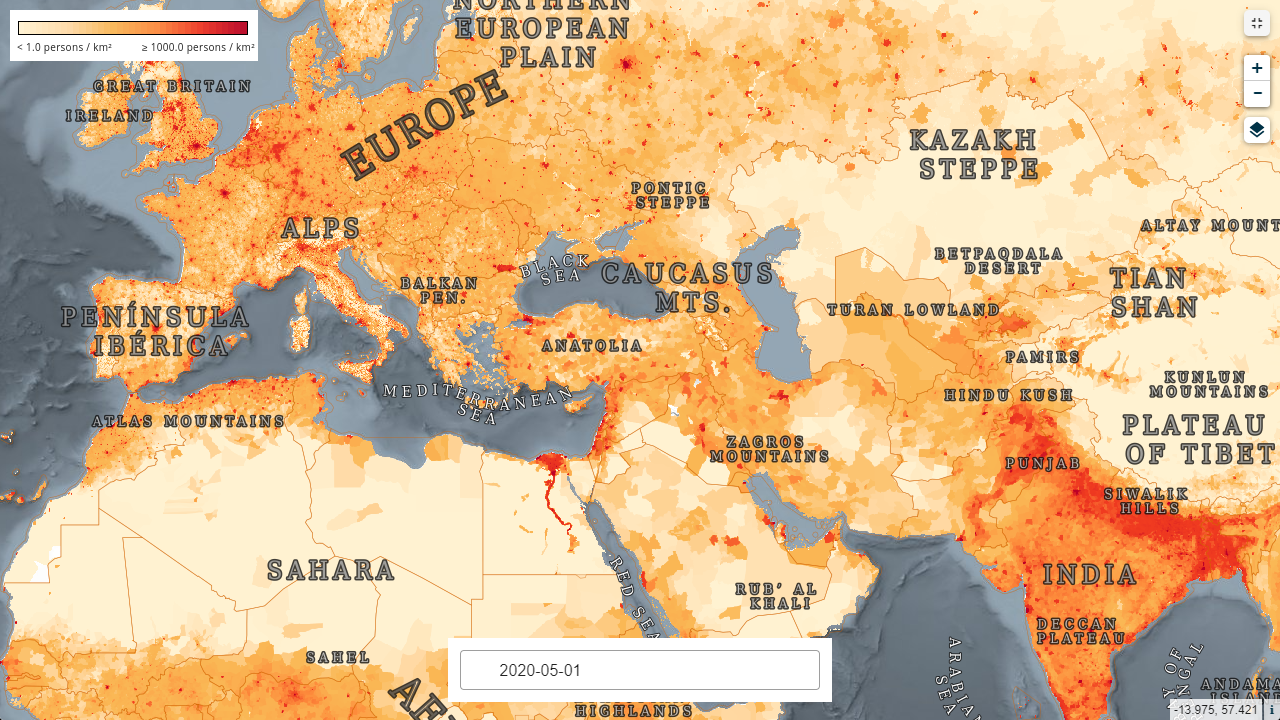
Global Population density map