High-Resolution Snow & Ice Monitoring; River and Lake Ice Extent S1+S2
Short description
The River and Lake Ice Extent S1+S2 (RLIE S1+S2) product is part of the Copernicus Land Monitoring Service (CLMS), pan-European High Resolution Snow and Ice Monitoring (HR-S&I) Ice product suite. The River and Lake Ice Extent (RLIE) products measure the presence of ice in rivers and lakes described by the EU-HYDRO network database, in particular the area of snow-free or snow-covered ice. The RLIE S1+S2 product is computed from the combination of RLIE S1 and RLIE S2 products. The RLIE S2 product from a given day is gap-filled using the RLIE S1 information from the same day. Because the RLIE S1+S2 is only produced when RLIE S2 and RLIE S1 products are aquired on the same day, it is delivered in delayed-time for the entire EEA39 zone. More information about the RLIE S1+S2 product methodology and workflow is outlined in the product user manual.Band information
The RLIE S1+S2 contains three layers: (1) the extent of rivers and lakes, (2) quality layer with confidence levels (QC), and (3) quality flags (QCFLAGS).| Band Name | Sample Type | Expected Values | Description |
|---|---|---|---|
| RLIE | UINT 8 | 1 - open water, 100 - snow covered or snow - free ice, 254 - other features, 205 - cloud or cloud shadows, 255 - no data | River and lake ice extent |
| QC | UINT8 | 0 - high quality, 1 - medium quality, 2 - low quality, 3 - minimal quality, 205 - cloud or cloud shadow, 255 - no data | RLIE quality layer |
| QCFLAGS | bit 1 - dimension (bit 8 active) or topographic shadow (bit 8 inactive), bit 2 - standing water (bit 8 active) or unseen pixels due to topography (bit 8 inactive), bit 3 - radar shadow (bit 8 active) or sun elevation angle too low for an accurate topographic correction (from MAJA), (bit 8 inactive), bit 4 - water & wetness (bit 8 active) or solar elevation angle tangent to slope (from MAJA), (bit 8 inactive), bit 5 - imperviousness ≥75%, bit 6 - tree cover density, bit 7 - grassland, bit 8 - S1-provided information (active) or S2-provided information (inactive) | RLIE quality flags |
More information
More information about the RLIE S1+S2 product methodology and workflow is outlined in the product user manual.Representative Images
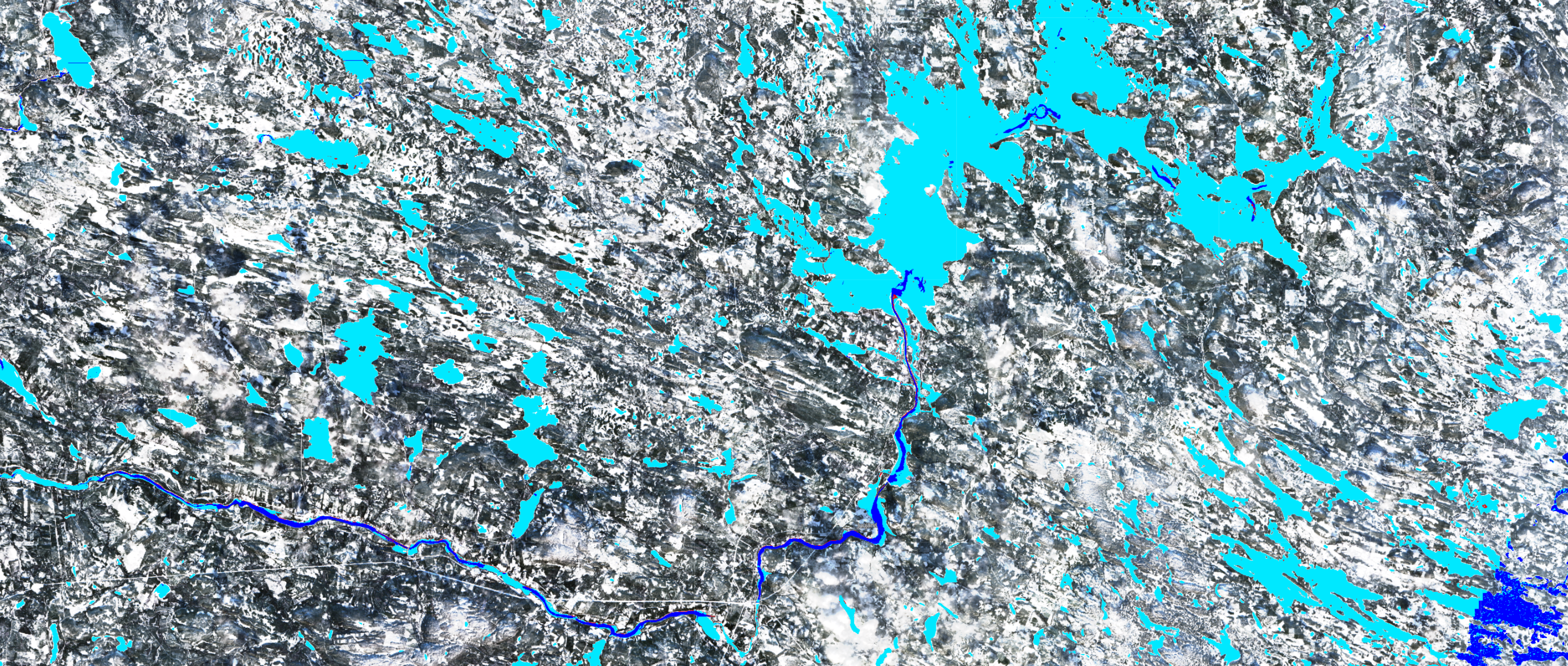 River and Lake Ice Extent S1+S2, 2021, Rovaniemi, Findland.
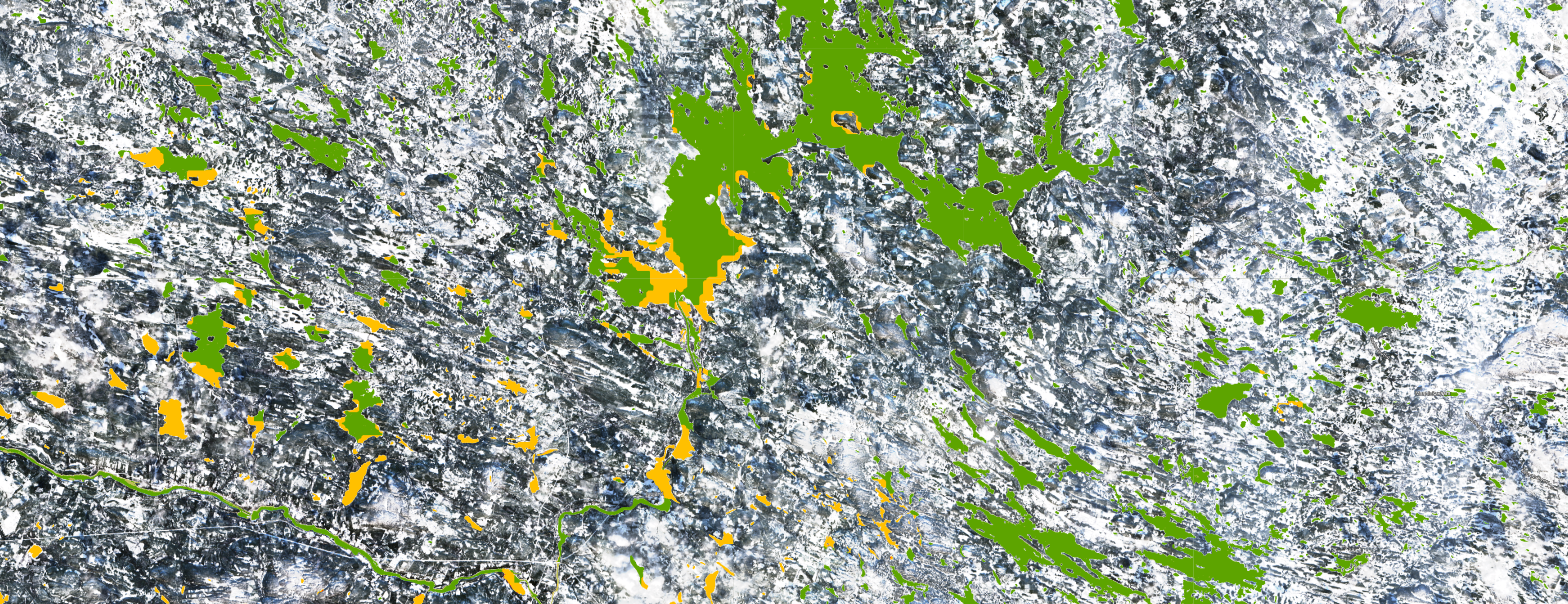
Confidence levels of the River and Lake Ice Extent S1+S2, 2021, Rovaniemi, Findland.