Ecosystem Map of Hungary
Short description
The Ecosystem Map of Hungary shows the distribution, extent and frequency of ecosystem types on national-scale. Although, mapping of agricultural and urban ecosystems was also a goal, the primary target areas of mapping were semi-natural areas. The map is suitable to serve as the basis of all further assessments of Ecosystem Services and green infrastructure. Top-down and bottom-up mapping approaches were combined to execute mapping, relying both on existing and regularly updated thematic databases and remote sensing images.The map was created within the frame of an EU-co-financed project: "Strategic Assessments supporting the long-term conservation of natural values of community interest as well as the national implementation of the EU Biodiversity Strategy to 2020". (KEHOP-4.3.0-VEKOP-15-2016-00001).
Mapping Methodology
The mapping methodology combined elements such as (1) image-based predictive mapping (using Random Forest classifier based on Sentinel-1,-2 and environmental data); (2) information derived from a (theoretical) data cube which was set up of various country-scale databases, and (3) high-level expert knowledge input (participatory method). The map is validated.Typology
Hierarchical with three levels; six main categories at the first level (Level 1) and 56 at the most detailed third level. Level 1 corresponds to the MAES level 2 types with a few adjustments. Typology_of_the_Ecosystem_Map_of_HungaryBand information
Ecosystem Map of hungary has one bandecosystem. The band values correspond to the ecosystem categories described in this excel sheet More information
Representative Images
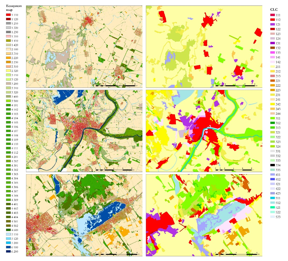
Illustration of CLC vs Ecosystem basemap