Sentinel-1 Radiometric Terrain Corrected SAR Backscatter
Short description
Sentinel-1 Radiometric Terrain Corrected SAR Backscatter is a product processed from
Sentinel-1 ground range detected (GRD) and is compliant with
CEOS Analysis Ready Data for Land (CARD4L) specifications for Normalised Radar Backscatter (NRB) products. CARD4L compliant products fulfil requirements for general metadata, per-pixel metadata, radiometric and atmospheric corrections and geometric corrections outlined in the NRB
product family specifications. These products are processed using Sentinel Hub
CARD4L generation tool and are radiometrically calibrated to γ° (gamma-nought) backscatter, and provided as linear backscatter power. Full radiometric terrain correction (RTC) based on the technique developed by David Small[1], has been applied using the
Copernicus DEM in order to mitigate topographic terrain effects on the backscatter induced by side-looking geometry of SAR imaging and compounded by rugged terrain. Speckle filtering has not been applied in order to preserve spatial resolution and user freedom.
The twin Sentinel-1A and 1B satellites are designed to acquire data with a revisit cycle of 6 to 12 days providing continuous all-weather, day and night imagery for Land and Maritime Monitoring. This collection is comprised of CARD4L compliant Sentinel-1 VV and VH backscatter products over Africa for archived data, with new acquisitions being updated daily as they become available. To obtain CARD4L compliant Sentinel-1 data for other parts of the world, registered users have the possibility of custom processing using
CARD4L generation tool.
Product specifications
Table 1: Sentinel -1 RTC backscatter product specifications
| Specification |
Description |
| Data source |
Sentinel-1 GRD (read more) |
| Sensor |
C-SAR |
| Frequency |
C-band (5.405 GHz) |
| Acquisition mode |
Interferometric Wide (IW) swath mode (read more ). |
| Polarisation |
VV + VH |
| Backscatter |
Gamma-0 (γ°) |
| Backscatter scaling |
Linear power |
| Coordinate reference system |
EPSG: 4326 |
| Pixel spacing - X (degree) |
0.0002 (≈22.2 m at the Equator) |
| Pixel spacing - Y (degree) |
0.0002 (≈22.2 m at the Equator) |
| Number of bands |
5 |
| Digital Elevation Model |
Copernicus DEM (10m in EEA, 30m elsewhere) |
Table 2: Sentinel -1 RTC backscatter product bands
Read more details on the bands
here
| Name |
Description |
Typical Range |
Sentinel Hub units |
| VV |
Linear backscatter intensity in VV polarization |
0 - 0.5 (Can reach very high values such as 1000) |
LINEAR_POWER |
| VH |
Linear backscatter intensity in VH polarization |
0 - 0.5 (Can reach very high values (such as 1000) |
LINEAR_POWER |
| MASK |
Data mask |
0, 1, 2 |
DN |
| AREA |
Normalized scattering area |
0 - 2 (Can reach high values on fore-slopes.) |
DN |
| ANGLE |
Local incidence angle |
0 - 180 degree |
DN |
Table 3: Sentinel -1 RTC backscatter product Data mask definition
| Value |
Description |
| 0 |
Nodata |
| 1 |
Valid data |
| 2 |
Invalid (in/near radar shadow) |
References
Representative Images
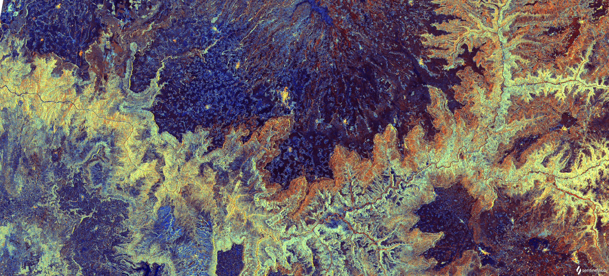
RGB visualisation of Blue Nile river looping across northwest Ethiopia . Contains modified Copernicus data [2022], processed by Sentinel Hub.
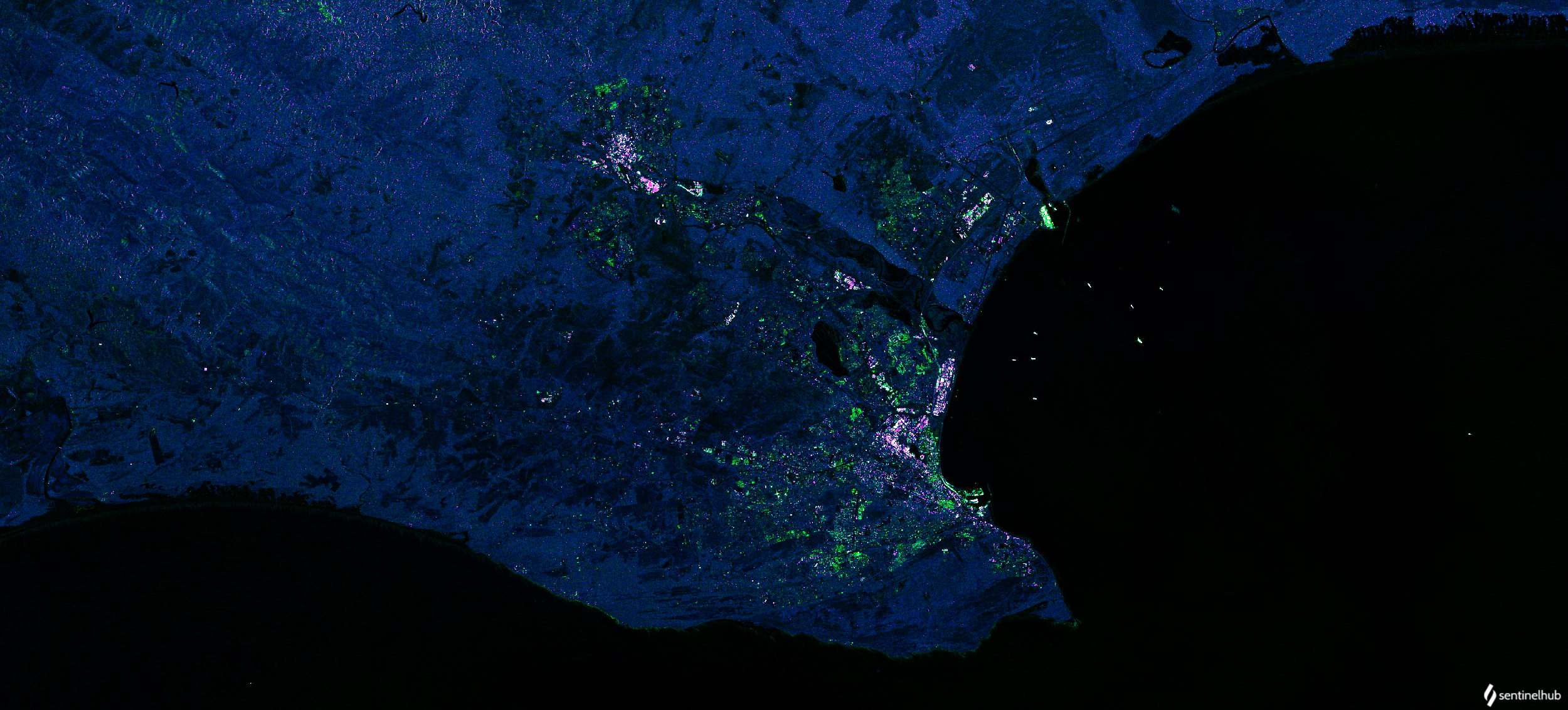 Visualisation of Port Elizabeth, South Africa based on Urban Areas Script. Contains modified Copernicus data [2022], processed by Sentinel Hub .